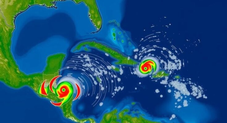
Meteorologists are monitoring a low-pressure system in the Central Atlantic which could develop into Tropical Storm Nadine. The National Hurricane Center assigns a 20-30% chance of this formation occurring within the week. However, experts caution that recent unfavorable conditions make significant intensification unlikely, with projections indicating the storm’s path towards Puerto Rico and the Dominican Republic rather than Florida.
As the Atlantic witnesses the brewing of a new tropical storm, meteorologists are evaluating the likelihood that this system could escalate to Tropical Storm Nadine, following its current designation as a low-pressure system in the Central Atlantic. According to the National Hurricane Center (NHC), the storm possesses a 20 percent probability of intensifying to tropical cyclone strength within the next 48 hours, increasing to 30 percent over the next week. The NHC has indicated that the current showers and thunderstorms associated with this system remain disorganized but may develop as it progresses westward, potentially impacting the Virgin Islands and Puerto Rico before moving towards Hispaniola and the southeastern Bahamas. However, strong upper-level winds may inhibit further development by the weekend. Hurricane experts like Brian Tang, an associate professor of atmospheric science at the University at Albany, have assessed the situation, noting that a 20 to 30 percent chance of formation suggests limited potential for the disturbance to morph into a tropical depression or storm. A tropical depression is defined as a low-pressure system that develops over warm waters with organized wind circulation, while a tropical storm emerges when wind speeds reach between 39 and 73 mph. Annalisa Bracco, a professor of ocean and climate dynamics at the Georgia Institute of Technology, elaborated on the conditions necessary for storm intensification, emphasizing the role of warm sea temperatures, low wind shear, and stratification of surface salinity. The current system varies significantly from Hurricanes Milton and Helene, which demonstrated dramatic intensification under favorable conditions. Nicholas Grondin, an assistant professor at the University of Tampa, provided context by referencing past storms that took similar tracks, suggesting that an observed lack of growth does not preclude future intensification if conditions become favorable. Nonetheless, challenges such as increasing wind shear may restrict this system from approaching Tropical Storm Nadine status. While current models predict the storm’s path towards Puerto Rico, the Dominican Republic, and Haiti, an imminent high-pressure system over the eastern U.S. and a cold front off Florida’s coast indicate that the storm is unlikely to affect Florida. If conditions remain unchanged, Tang does not foresee any significant risk for Florida residents, though Grondin cautioned that should the storm strengthen and shift towards Florida, it would likely bring substantial rain and gusty winds, primarily impacting southern regions. In summary, while the potential for the development of Tropical Storm Nadine exists, current atmospheric conditions suggest a muted likelihood of intensification. The evolving weather patterns and the storm’s trajectory will continue to be monitored closely.
The article discusses the formation of a potential tropical storm, designated as Tropical Storm Nadine, currently represented as a disorganized low-pressure system in the Central Atlantic. Tropical storms can escalate in intensity, and experts are analyzing various environmental factors that influence such developments. The piece specifically examines predictions from the National Hurricane Center on the storm’s potential trajectory and the various meteorological principles that govern storm dynamics. Additionally, it draws comparisons to recent hurricanes to provide context on the system’s expected behavior and likelihood of impacting different regions along its path.
To summarize, hurricane experts assert that while a potential tropical storm Nadine is under observation, the likelihood of it strengthening into a significant storm remains low due to less than ideal environmental conditions. The storm’s trajectory indicates it may approach lands such as Puerto Rico and the Dominican Republic while posing no substantial threat to Florida. Continuing observations and forecasts will refine the understanding of how this developing system may evolve.
Original Source: www.newsweek.com


