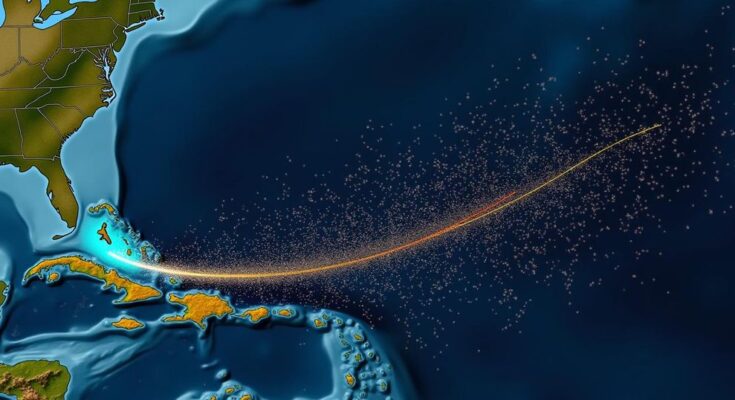
The National Hurricane Center is monitoring three named storms—Isaac, Joyce, and Kirk—post-Hurricane Helene, which caused extensive damage and fatalities in the U.S. None of the systems are expected to make landfall in the U.S. Isaac is expected to head towards Europe, Joyce will likely dissipate, and Kirk may shift northeast. Additionally, two disturbances are being observed for potential development that could affect the Gulf Coast.
The National Hurricane Center (NHC) is currently monitoring three named tropical storm systems—Isaac, Joyce, and Kirk—in the aftermath of Hurricane Helene’s destructive path. Thankfully, none of these systems is anticipated to make landfall in the United States. Hurricane Helene, which struck land last Thursday night as a Category 4 hurricane, brought maximum sustained winds of approximately 140 mph near Perry in Florida’s Big Bend region. Devastation occurred across several southern and southeastern states, resulting in fatalities due to storm surge, high winds, and torrential rainfall. The storm yielded over 100 fatalities, as reported by the Associated Press. Following Hurricane Helene, the Atlantic hurricane season has intensified, with the emergence of these three named storms. Presently, post-tropical cyclone Isaac is located to the northeast of the U.S. over the open ocean, exhibiting maximum sustained winds of 60 mph. To the southeast, Tropical Depression Joyce has maximum sustained winds of 35 mph. Meanwhile, Tropical Storm Kirk, situated southeast of Joyce, has sustained winds of 50 mph. According to the Cyclocane website, spaghetti models—which are computer simulations predicting potential storm trajectories—indicate that each of these storms will likely stay away from the U.S. Most forecasts for Isaac suggest a trajectory towards Europe, although continued weakening is expected prior to any landfall. Joyce is projected to dissipate by Monday. Kirk is anticipated to shift northeast towards Europe, although one forecast model suggests a southwest movement towards Guyana in South America. National Weather Service meteorologist Will Ulrich stated that Kirk may generate indirect effects along the Eastern Seaboard, specifically dangerous rip currents that could impact regions hundreds of miles from the storm’s center. Consequently, rip current warnings are forthcoming for the affected areas throughout the weekend and early next week. While it remains unlikely that Isaac, Joyce, or Kirk will strike the U.S., the NHC is monitoring two additional systems. One of these systems potentially poses a risk to the Gulf Coast if it continues to develop. Disturbance 1 is characterized as a large area of low pressure situated over the western and southwestern Caribbean Sea. While it is generating some thunderstorms, it is not expected to strengthen into a named storm within the next 48 hours. The NHC estimates a 40 percent chance of formation in the upcoming week. NHC experts commented, “Environmental conditions could become conducive for gradual development, and a tropical depression could form in a few days while the system is over the southern Gulf of Mexico or northwestern Caribbean Sea.” Those in the northwestern Caribbean Sea and along the Gulf Coast should remain vigilant regarding the progress of this system, as the likelihood of potential development might extend into late this week or over the weekend. AccuWeather’s lead hurricane expert, Alex DaSilva, conveyed that meteorologists had heightened concerns regarding Disturbance 1 several days prior. Although there is potential for development into a tropical storm or even a hurricane, DaSilva pointed out that the energy remains insufficiently consolidated and substantial intensification remains unlikely. Additionally, Disturbance 2, situated a few hundred miles south of the Cabo Verde Islands, carries a 30 percent chance of development within the next 48 hours and an 80 percent chance over the next week. Enhanced upper-level winds are anticipated to foster gradual development, leading to the likely formation of a tropical depression within a few days as it moves westward across the eastern tropical Atlantic. At present, spaghetti models for these two disturbances have yet to be made available given their nascent stages.
The Atlantic hurricane season, typically active from June to November, involves the monitoring and forecasting of tropical systems that can potentially lead to hurricanes affecting the United States and surrounding regions. The National Hurricane Center plays a crucial role in tracking these storms and providing pertinent updates to ensure safety and preparedness for the populations in vulnerable areas. The impacts of hurricanes can be catastrophic, as illustrated by Hurricane Helene, which resulted in significant loss of life and widespread destruction. As new systems arise, it is imperative to assess their trajectories and potential impacts, especially concerning the United States Gulf Coast and other regions.
In summary, the National Hurricane Center is closely observing the trajectories of three named storms—Isaac, Joyce, and Kirk—following the destructive passage of Hurricane Helene. Although the likelihood of these storms impacting the U.S. is minimal, monitoring is ongoing for two additional disturbances that could pose future threats. Public awareness and preparedness remain essential as the hurricane season progresses, and the NHC continues to provide crucial updates regarding storm developments.
Original Source: www.newsweek.com


